 Tạp chí

Nguyễn Quang Học (trang 62-67)
Từ khoá: quy hoạch, sử dụng đất, Kon Plong, Kon Tum, Tây Nguyên
Summary
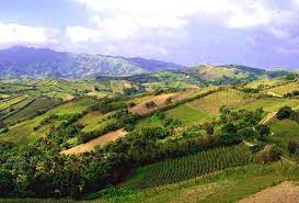
Land use planning in Kon Plong district Kon Tum province Tay Nguyen area
In Kon Plong district, existing land used in 2002 is 106,0555.533ha (77.6%) and the remaining unused land is 30,104.67 ha (22.11%0. Its economic and basic infrastructure conditions are still poor, population density is 12 persons/km2 with 98% of total population belong to ethnic minority groups. Land use planning up to 2010: of the total natural area 136,160ha, agriculture land will be 12,000ha (8.23%), increase of 7645.66ha; forest land will be 120,147.35 ha, increase 18,216.35 ha, area for specific uses 3,639.17 ha, resident area 340.54 ha, abundant land will reduce by 29,271.73 ha, equal to 832.94 ha. Coefficient of land used in 2002 was 1.77 times and in 2010 it will be reach 2.3 times.