 Tạp chí

Hoàng Văn Mùa, Trần Văn Chính, Nguyễn Hữu Thành (trang 38-41)
Từ khoá: phân loại, xây dựng, bản đồ đất, Nam Định, phương pháp định lượng, FAO-UNESCO
Summary
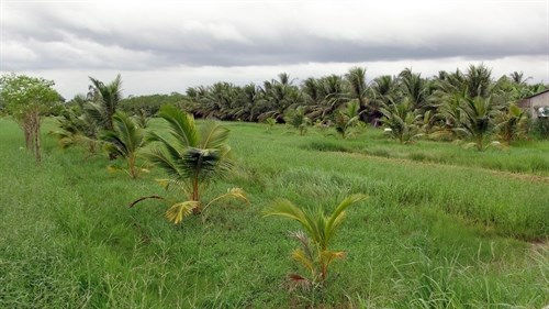
A study of soil classification and mapping for Nam Dinh province after FAO-UNESCO’s quantitative method
Results of soil survey in Nam Dinh: Main soil formation processes were the deposition of alluvial material, salinization, acidification, accumulation ò Fe and Al, inundation and erosion. Typical diagnostic horizons: A mollic, A umbric, A ochnic, H histic, B cambric, B argic and Sulfidic materials. Diagnostic properties: fluvic, salic, gleyic, stagnic, plinthite, ferric, base saturation. There were 7 soil goups: arenosols, salic fluvisols, thionic fluvisols, fluvisols, gleysols, acrisols & leptosols. Fluvisols accupy a largest area and very suitable for agricultural cultivation. Problem soils: arenosols, salic fluvisols, thionic fluvisols, gleysols and leptosols.